Supporting the Cook Islands Marine Park
The Cook Islands Prime Minister recently announced plans to establish a 1,000,000 square kilometer marine park, over half of their exclusive economic zone (EEZ). With help from Esri, our lab will be supporting this effort. Establishing a 1,000,000 square kilometer marine park is no easy task. The challenges include a legislative mandate, data and information about marine resources and human activities in the ocean, models and science used to assess existing conditions and prospective management plans, and a well designed planning and adaptive management process that puts stakeholders in the drivers seat.
Cook Islands Prime Minister Henry Puna has taken the first and necessary step of declaring his intentions to establish a park. In December, I met with Mr. Puna along with Jack Dangermond (CEO of Esri, Inc.), Mike Donoghue (Conservation International), Louisa Wood (UNEP-WCMC), and Sylvia Earle to discuss how we could support this grand vision. Jack offered to support the process by sending Chad Burt and myself to the Cooks to begin discussions about how we might use SeaSketch to support the planning effort.
Clearly, managing ocean resources in the Cook Islands is something that has to be driven by local government and stakeholders. The design, implementation, monitoring and adaptive management of the Cook Islands Marine Park (CIMP) could potentially draw on the lessons learned from large scale planning efforts in other geographic regions and cultures, but my involvement should be limited to that which is invited and valued by inhabitants of the Cooks.
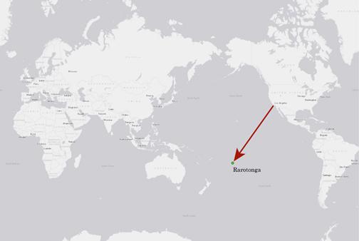
Working under the direction of Liz Koteka, Director of Central Policy and Planning in the Office of the Prime Minster, and in collaboration with Sue Taei, Director of the Pacific Islands Marine Program for Conservation International, I assisted with organizing a workshop, March 14-16, in Rarotonga. This workshop will bring together experts from the Cooks, international NGOs and academic researchers to begin exploring how SeaSketch may be useful to the CIMP planning process.

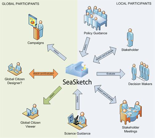
SeaSketch, a web-based application designed for collaborative GeoDesign of ocean space, could be implemented in any number of ways for CIMP planning. It could be used to support planning by government officials and resource managers only. It could be used to support planning by Cook Island stakeholders and government officials. It could be used to disseminate information about the planning process (e.g., what plans have users drawn by those with permission) to citizens of the Cook Islands or, if connected to the Internet, citizens of the world. Global citizens could even contribute their own ideas (sketches) to the planning process.

I like the idea that Cooks Islanders could sketch prospective marine park designs, discover the ecological and economic implications of those designs, and then propose their own solutions for how the oceans governed by the Cook Islands are used. I also like the idea that the global community could watch how those proposed solutions are developing and offer feedback or alternative solutions through SeaSketch with the understanding that, ultimately, those comments or alternatives could be considered or rejected by Cook Island stakeholders at any point in time.
I have yet to learn about the governance structure in the Cooks, how stakeholders will be engaged, and the level to which the government and stakeholders will want to engage the global community. At the CIMP workshop in March, I intend to present how SeaSketch can be used at all levels and listen carefully as to what will work and what is welcomed by the leadership and stakeholders in the Cook Islands.


