About Us

SeaSketch is developed by the creative people in the McClintock Lab at the Marine Science Institute at the University of California Santa Barbara. Initial funding and support for SeaSketch has been provided by Esri, the New Zealand Department of Conservation, and The Tindall Foundation.
The McClintock Lab develops technologies to support marine spatial planning, monitoring and enforcement. Our applications are easy to use, quickly deployed, low-cost, and integrate a variety of open-source and proprietary tools.
Our Team
Will McClintock Director

Will McClintock, Ph.D., is a researcher at the University of California Santa Barbara, Marine Science Institute, and a member of the Center for Marine Assessment and Planning. Dr. McClintock received his B.A.in Biology from Earlham College, M.S. in Behavioral Ecology from the University of Cincinnati, M.A. in Counseling Psychology from Pacifica Graduate Institute, and Ph.D. in Ecology, Evolution and Marine Biology from the University of California Santa Barbara.
Chad Burt Lead Developer
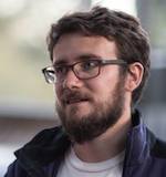
As Lead Developer, Chad Burt is responsible for the design and development of web applications created by the McClintock Lab. Chad led the development of the MarineMap decision support tool, and has created innovative data visualization applications for the National Park Service, PISCO, and Santa Barbara Coastal LTER. He also contributed content for the launch of Ocean in Google Earth. Chad received a B.A. in Biology from the University of California Santa Barbara College of Creative Studies program, and spent time as a research diver before joining the McClintock Lab.
Todd Bryan Senior Developer
Todd Bryan works on the design and implementation of SeaSketch. He has extensive experience in commercial software development, having served as tech lead for GoToMeeting and GoToWebinar at Citrix Online. He was also one of the initial employees at the cloud computing firm RightScale.
Dan Yocum Spatial Analyst

As the spatial analyst for SeaSketch, Dan Yocum is responsible for translating the analytical needs of clients to the geoprocessing reports produced within SeaSketch. He also serves as the liason between the Sustainable Fisheries Group and SeaSketch, helping to integrate the data and models produced within each organization. Dan has a background that spans academic and professional work in software engineering and earth and environmental sciences. After receiving a Masters degree from Carnegie Mellon University in Human-Computer Interaction, Dan spent a decade as a software engineer at a variety of start-ups, creating intuitive and easy to use software. He recently received a Masters of Environmental Science and Management from the Bren School at UCSB.
Grace Goldberg Project Manager

Grace Goldberg coordinates lab activities, and serves as an interface between the lab and collaborators. She is trained as a scientist, interested in research questions that include human users in marine ecosystems, with relevance to spatial management and real conservation goals. Grace received her M.S. in Marine Systems and Conservation from Stanford University, completing a thesis on sea turtle spatial dynamics to inform sustainable development. She spent time at Hopkins Marine Station as a scientific diver, and in the Earth Systems Program, which focuses on interdisciplinary environmental problem solving, systems thinking, and communication.
Charla M. Burnett Community-based Spatial Planning Research Fellow

Charla M. Burnett is a doctoral student in the Global Governance and Human Security program at the University of Massachusetts Boston. Studying the intersections between migration, land-use planning, and human security. Her dissertation focuses on critical spatial representation of human development. Charla holds a Masters in Conflict Resolution and Peacebuilding from the School of International Training (SIT) where she worked for the United Nations Relief and Works Agency in Palestine refugee camps in the West Bank. Her BA is in Global Studies in Peace and Justice with a minor in French from Michigan State University. In addition, she holds certificates in SALT Triage training, Management Engineering, and Disaster Risk Management. As the Community-based Spatial Planning Research Fellow for the McClintock Lab at the University of California Santa Barbara, Charla will monitor literary and case study databases on spatial planning, process planning, and community-based engagement. Assisting our SeaSketch Lab, she will provide analytic feedback for publication, consultation, and engagement in new geographic information systems in the United States and abroad. Specializing in mediation in Public Private Partnership, she will be provided opportunity for field experience working with multiple stakeholders.
Collaborators
Ben Halpern

Ben Halpern is a Professor at the Bren Schol of Environmental Science and Management and Director of CMAP. He also serves as Project Coordinator for a large project on Ecosystem-Based Management (EBM) of coastal marine systems, based at the National Center for Ecological Analysis and Synthesis, and is a lead scientist for the Ocean Health Index project. Much of his research addresses issues related to Coastal and Marine Spatial Planning (CMSP), including cumulative impact and ecosystem service tradeoff assessments.
Eric Poncelet
Eric is a Senior Director and Senior Mediator with Kearns & West (K&W) in San Francisco and heads up K&W’s marine practice. He has over 15 years experience designing, facilitating, and analyzing collaborative stakeholder processes in the natural resource management domain. Recent projects include working with the California Marine Life Protection Act Initiative to designate marine protected areas (MPAs) off the California coast and the California Marine Protected Area Monitoring Enterprise to develop associated MPA monitoring plans. He has also supported numerous initiatives by the California Ocean Protection Council (OPC), NOAA, and the West Coast Governors’ Agreement on Ocean Health, including revision of the OPC’s strategic plan, conducting a geospatial information management system needs assessment, supporting implementation of California’s sustainable seafood initiative, and designing and facilitating various public and technical workshops to support coastal and marine spatial planning and resource conservation efforts. Eric holds a B.S. in Mechanical Engineering and a Ph.D. in Cultural Anthropology, and is a roster member of the U.S. Institute for Environmental Conflict Resolution. Publications include the book Partnering for the Environment - Multistakeholder Collaboration in a Changing World (2004).
Dawn Wright

As Chief Scientist at Esri and a notable authority in geographic information science, Wright has for the past 16 years teamed with scientists worldwide who use GIS to map and analyze terrains, ecosystems, and habitat. She combines her expertise as a geographer and GIS user to map the seafloor; design geospatial solutions for coastal mapping and charting; and advise organizations on oceanography and fisheries, including her current service on the National Academy of Sciences Ocean Studies Board. She has worked with the GIS community to develop data models and create solutions for analyzing the ocean.
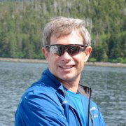
Patrick Halpin

Patrick Halpin is the Gabel Associate Professor of the Practice of Marine Geospatial Ecology and Director of the Geospatial Analysis Program at the Nicholas School of the Environment and Earth Science, Duke University. Prof. Halpin’s research focuses on marine geospatial analysis, ecological applications of geographic information systems and remote sensing; marine conservation and ecosystem-based management. Marine Geospatial Ecology Lab
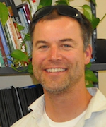
Matt Merrifield

Matt Merrifield is the Chief Technology Officer (CTO) for The Nature Conservancy in California. He has lead the development of eCatch, an electronic logbook and monitoring system used by fishermen in California. Merrifield was also a principal investigator in the MarineMap Consortium, pioneering the development of the MarineMap Decision Support Tool.
Crow White

Crow White is an Assistant Professor of Biology at Cal Poly San Luis Obispo. His research focus is on theoretical and applied, temporally- and spatially-explicit bio-economic modeling of alternative renewable natural resource management strategies, and empirical evaluation of the ecological implications of these strategies. In his work at Cal Poly he is designing and testing ecosystem-based and resource rights-based solutions to conservation and market failures in fishery management. Additionally, he works on decision-theoretic and portfolio theory analysis of tradeoffs among interacting ecosystem services, and develops and applies marine spatial planning for mediating user group conflicts.