Survey tools creating a broadly distributed use and values survey allowing the public to respond with specific points of importance
Sketching tools enabled stakeholders to draw and modify prospective protection management and special management zones
Reporting tools provided feedback on ecological integrity, human well-being and governance issues pertaining to prospective zones
Key Features Used
Visit the SeaSketch Project
Sea Change – Tai Timu Tai Pari
The Hauraki Gulf, also known as Te Moananui ā Toi, is one of New Zealand’s most valued and intensively used resources. With its rich history of human settlement the area is of utmost cultural and spiritual significance, particularly to māori. With New Zealand’s fastest growing city, Auckland, at its doorstep the Gulf is used for food gathering, recreation, boating, in addition to supporting a myriad of industries including a burgeoning tourism industry.
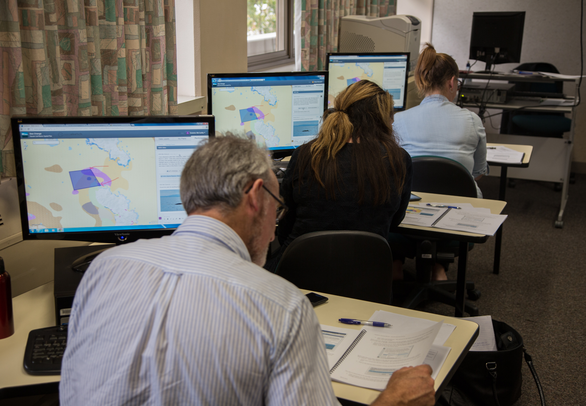
Auckland and Waikato Councils staff receive SeaSketch training.
In December 2013, New Zealand’s Minister of Conservation initiated Sea Change – Tai Timu Tai Pari, a collaborative marine spatial planning process aimed at developing a plan to reverse the declining health of the Hauraki Gulf Marine Park and secure a productive and sustainable Gulf for the future. To ensure that the plan reflected the many interests and aspirations in the Gulf a stakeholder working group (SWG), consisting of 14 representatives of māori, environmental groups, the dairy and aquaculture industry, commercial and recreational fishing, and local communities, was tasked with developing the plan.
A partnership of māori with local and central government provided oversight over the process and the sponsoring agencies supported the process with dedicated administrative, technical and science support.
Hauraki Gulf Marine Spatial Plan
After 3 years in the making, New Zealand’s first marine spatial plan was launched in December 2016. The plan delivers a bold and holistic vision for restoring the māori (life force and vitality) of the Hauraki Gulf and presents a set of integrated objectives and actions designed to achieve this. Amongst other, the plan proposes:
- A network of Marine Protected Areas consisting of 11 new no-take marine reserves, the extension of two existing ones, and the protection of benthic habitats.
- Active restoration of degraded habitats, incl. the vast shellfish beds once found throughout the inner Gulf
- The phasing out of bottom-contacting fishing methods.
- The Ahu Moana initiative provides for the joint management of nearshore environments by mana whenua and local communities to achieve protection and fisheries management outcomes via small-scale adaptive management based on local and traditional (mātauranga māori) ecological knowledge.
- 13 new indicatives sites for the expansion of environmentally sustainable marine farming.
- Catchment management plans setting limits for sediments, nutrients and heavy metals getting into the marine environment from land-based activities.
The Plan can be viewed at http://seachange.org.nz/Read-the-Plan/.
How was SeaSketch used?
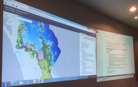
SeaSketch facilitates planning meetings.
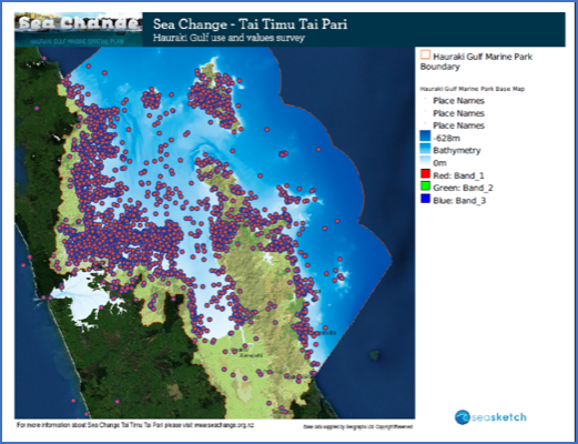
Survey responses collected with SeaSketch survey tool.
- About 100 layers of publicly available geospatial information on current management, biodiversity values, ecosystem services, existing uses and activities, contaminants, and catchments.
- The Hauraki Gulf use and values survey, designed by University of Auckland researchers and run on SeaSketch in early 2014. 1500 people participated describing their uses and values associated with 4500 sites across the Gulf. With a completion rate of 35% (number of surveys filled out and submitted divided by the number of surveys started), SeaSketch demonstrated its value as a powerful crowdsourcing and engagement tool. Insights gained from this study were presented back to the SWG.
- Used in and outside of meetings during the various stages of development of spatial plan proposals by the SWG. For example, layers on depth, substrate and other physical properties were used to draw prospective areas for aquaculture development. Layers on biodiversity values and coastal areas of high natural character were subsequently used to modify proposals to minimize the impact on biodiversity and landscape values. Likewise, the development of MPA proposals included capturing local ecological knowledge on areas of high biodiversity value and modifying these according to the impact on the commercial and recreational fishing values reported by SeaSketch’s analytical tools.
Now What? The plan is non-statutory and therefore not legally binding. It was symbolically handed over to central and local government in December 2016 and relevant agencies are currently analyzing the broad suite of plan proposals and discussing the next steps regarding its implementation.