SeaSketch Supports Collaborative Planning for our Oceans
SeaSketch puts powerful tools into the hands of ocean planners, stakeholders and the public that were once limited to GIS professionals, enabling participatory marine spatial planning processes that are closely tied to the relevant science and information. SeaSketch is being used around the globe in small agency teams and large community-driven initiatives to make better management decisions every day.

Fast, easy to use design tools
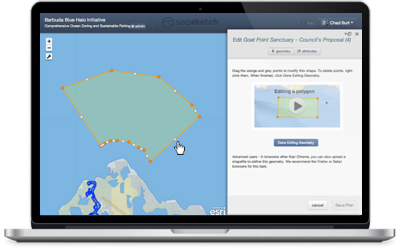
SeaSketch is designed first and foremost to be easy to use. Users can generate hundreds of alternative proposals representing a range of perspectives and interests in our accessible map interface. Zoning, regulatory, or management plans can now incorporate the diverse ideas of stakeholders most affected by those decisions, in addition to those of the planners and scientists involved.

Analytical Reports give immediate feedback
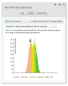
SeaSketch provides analytical feedback about your sketched zone within seconds. These reports can identify habitats protected, potential social or economic costs and benefits, and other metrics that can inform the development of broadly supported marine spatial plans. They can even include advanced analyses such as Marxan and Cumulative Impacts.
This fast, easy to use workflow encourages iterative design to meet planning objectives. Best of all, your users need not install or buy any expensive software to use these tools. They simply sketch their ideas, and edit based on the report's immediate feedback.

Advanced collaboration & engagement tools
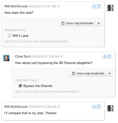
SeaSketch can be used to engage stakeholders face-to-face and online, making previous barriers of distance or competing schedules a thing of the past. Users can share their sketches, discuss their ideas, share views of maps, and post file uploads to discussion forums. Process facilitators have powerful tools to organize discussion forums to encourage cross-interest discussion and collaboration, or limit some discussions to specific groups of users.
Long gone are the days of tracking public comment in Excel spreadsheets. Participants are empowered to continue contributing and discussing outside of sit-down meetings.
Could SeaSketch help facilitate ocean management in your region?
"SeaSketch benefits countries through its inclusiveness without limits to national capacities on GIS expertise. It gives all stakeholders equal opportunities to raise their voices and to participate without cost."
- UNEP MedOpenSeas project briefing, multi-nation planning in the Mediterranean
SeaSketch can be configured to support both large participatory projects, or small group exercises. There are simple licensing options and opportunities for training, custom development work, and spatial data hosting.
Learn more about using SeaSketch in your organization
Looking for a SeaSketch project near you?
SeaSketch is in use around the globe by ??? users in ??? active projects. Shown here is planning activity from 2013 - Present. Find a project near you.


