How to Support the West Coast Regional Planning Body with SeaSketch
On October 26 & 27, 2016, the West Coast Regional Planning Body (WCRPB) met to discuss how it might support and harmonize sub-regional marine spatial planning efforts. Interestingly, the WCRPB will not be planning in the traditional sense (i.e., drawing lines on maps). Rather, they will work to support sub-regional planning efforts to ensure that they use the best-available science, understand the tradeoffs and consequences of options as they are developed, and that they are transparent and properly facilitated.
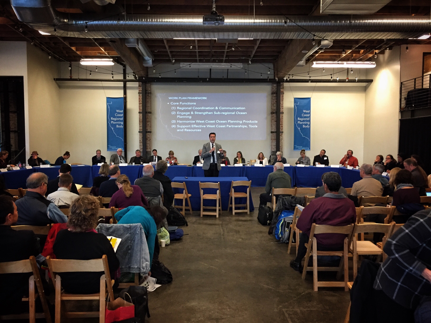
John Hansen, Marine Planning Coordinator, addresses attendees at the West Coast Regional Planning Body meeting, Portland, OR. The WCRPB is seated behind him.
Along those lines, Andy Lanier, Steve Steinbeck and Allison Bailey reviewed the West Coast Ocean Data Portal, a platform for discovering geospatial information relevant to West Coast planning efforts. The WCRPB members agreed that sub-regional planning groups could use the data exposed in the Data Portal (and other sources) to develop new models and analyze the value and consequences of prospective pans.
As a first step, I'd like to see sub-regions use SeaSketch to visualize data from the portal and use the discussion forums to generate ideas on what datasets are useful, which need improvement and where there are data gaps. For example, as marine spatial planning begins to take shape in San Diego, planners can import data found in the West Coast Ocean Data Portal, and stakeholders can inspect them and talk about whether they are appropriate for planning purposes.
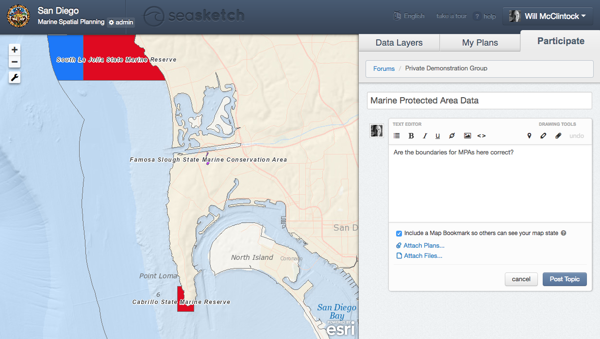
Discussing a data layer (Marine Protected Areas) in a demonstration project for San Diego marine spatial planning (sandiego.seasketch.org).
Each sub-region will have different planning goals and objectives. Some areas may focus on aquaculture development, commercial shipping and military uses, while others may focus on renewable energy, conservation and fishing. The specific goals and objectives will determine how plans will be evaluated by sub-regional planning bodies.
If SeaSketch is used to sketch evaluate proposed marine spatial plans, we could use tradeoff models in combination with geodesign principles that allow users to sketch any prospective plan (e.g., aquaculture sites, renewable energy sites, fishing zones) and evaluate its relative value.
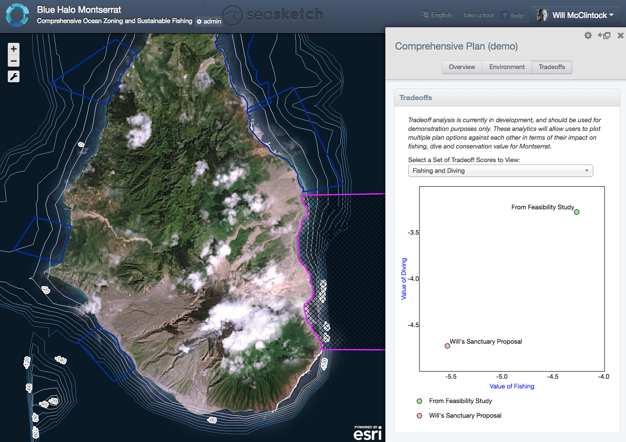
Evaluating tradeoffs for marine spatial plans for Montserrat (montserrat.seasketch.org).
As sub-regional planning moves forward independently throughout the West Coast, the WCRPB might consider evaluating sub-regional plans within the regional context and provide sub-regional planning bodies with useful feedback before plans are submitted to the National Ocean Council for approval. That is, the WCRPB may not be developing plans per se, but they could use SeaSketch to evaluate the sub-regional plans using, say, a cumulative impact analysis.
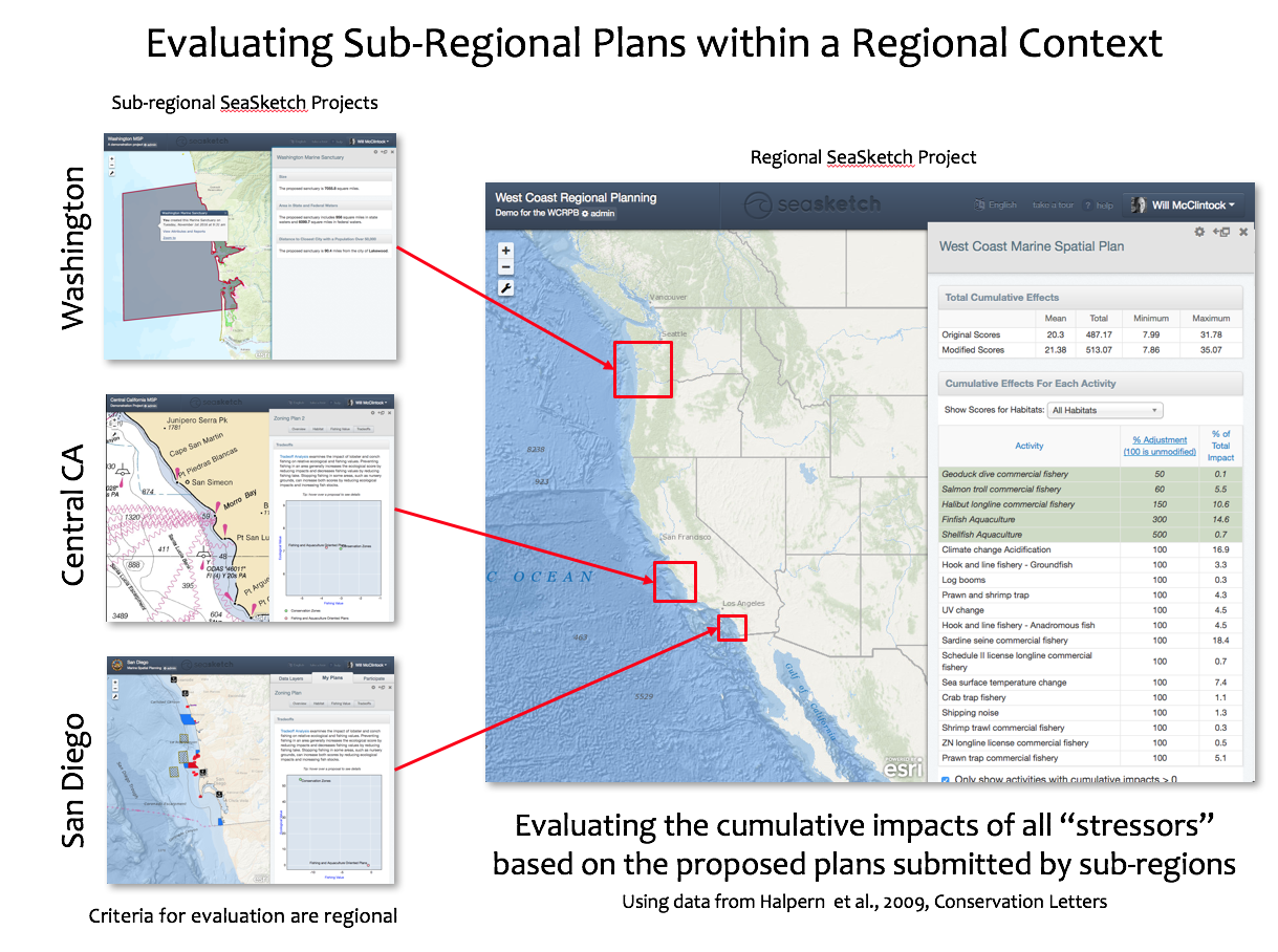
A regional cumulative impact model has already been created by Halpern et al (2009) though perhaps it could be updated. That's easy enough. Once the models are freshened up, they can be imported into SeaSketch. The WCRPB members could then accept any plans developed by sub-regions and calculate how they may increase or decrease impacts to ecosystems in the California Current.
We have already provided WWF-Canada for this kind of tool to be used when stakeholders develop plans in British Columbia.
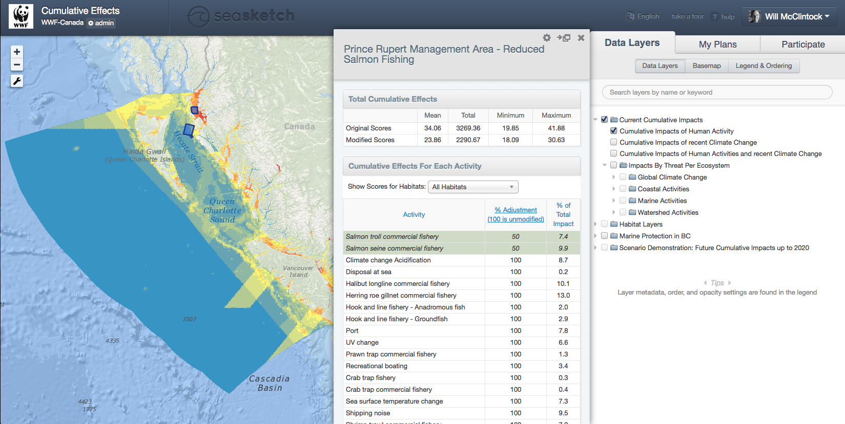
Evaluating cumulative effects of human activities in British Columbia (cebc.seasketch.org).
So, what needs to happen? Our vision is for the WCRPB to make SeaSketch available to any sub-region within the West Coast planning region. Then, the WCRPB will support the science to update the California Current Cumulative Impact models and the implementation the above described sketching and evaluation tools for the West Coast.
To learn more, contact Will McClintock (will@ucsb.edu).


